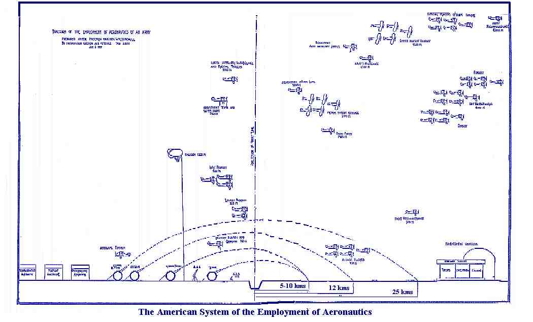
This diagram represents a vertical section of the air as it would appear to one able to see every part of aviation on a good day during our operations of September, October, and November 1918. The notch in the horizontal line indicates the trench or dividing line between hostile territory, which is on the right of the vertical line projected up above it, and friendly territory, which is on the left. On the ground the opposing infantries face each other on the trench line. The anti-aircraft machine guns are shown close to the troops, and the anti-aircraft artillery immediately behind them. The heights at which the various aviation acts are indicated in meters. The special pursuit details, acting at a great altitude (practically as high as they can get) work directly against the enemy's reconnaissance machines. Our own Army reconnaissance, acting up to 20,000 feet, habitually went thirty or forty miles into the enemy's territory. The Army's surveillance machines kept cruising over the front to report from their own position, by wireless, whatever they could see, so that it could be immediately attacked by their aviation elements. The pursuit and day bombardment elements, shown to the right of the diagram together, indicate the independent or strategical aviation, which acts by itself directly against the enemy aviation and his ground troops.
 |