
The Somme, 1-Jul-1916
 |
| A British unit awaits their time to "go over the top" on the morning of 1-Jul-1916. Artist unknown. |
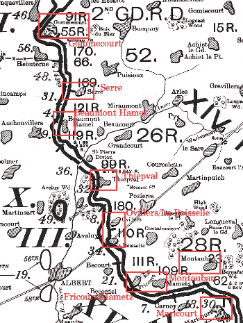
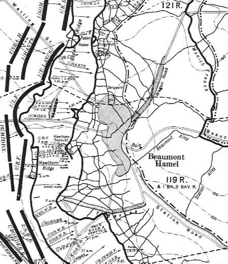
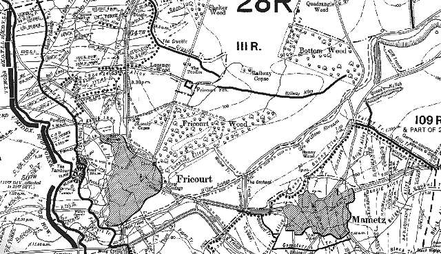
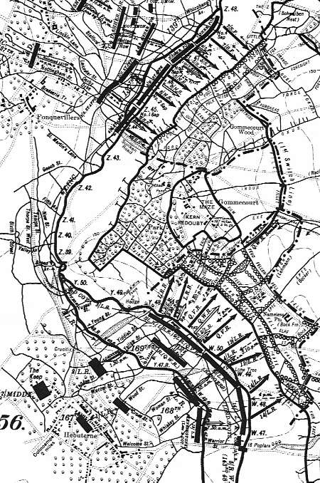
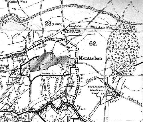
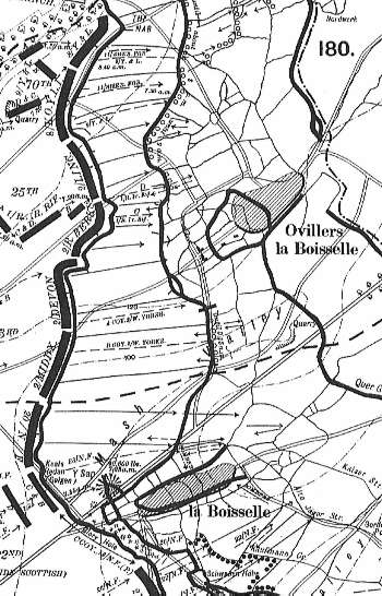
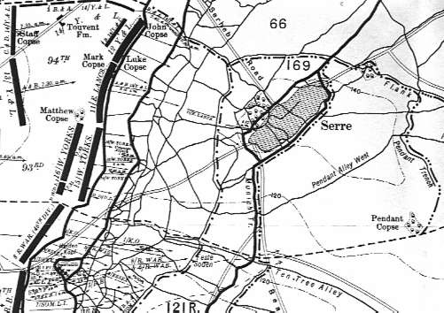
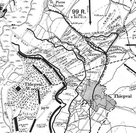
These maps show the British sector activity and positions 1-Jul-1916. The river Somme is located off the map just below Maricourt. Click here for a zoomout map of the area.
|
Netscape 2.0 and IE 2.0 users: Just click on the area that you want to zoom.
For other browsers select from the list below:
| Beaumont Hamel | Fricourt/Mametz | Gommecourt | Maricourt | Montauban | Ovillers/La Boisselle | Serre | Thiepval |
| Note: These maps were reproduced from sets published by ø The Battery Press in conjunction with the Imperial War Museum. If you are interested in detailed boxed map sets of World War I, you should visit their online catalog using the above link for pricing and ordering information. The set is much more detailed than the small sample presented here. |